How to Navigate National Parks Without Cell Service: Maps, Apps, and Offline Tools

Most visitors discover the harsh reality only after arriving at their destination: cell towers don't reach into America's most pristine wilderness areas. While this digital disconnect offers a refreshing break from notifications, it can create genuine navigation challenges for unprepared hikers.
Successfully exploring national parks without cell service requires preparation, the right tools, and basic navigation skills. This guide covers essential offline navigation methods, recommended apps, and practical strategies to help you confidently explore America's natural treasures.
Essential Offline Navigation Tools
Traditional navigation tools remain your most reliable companions when technology fails. These time-tested resources never need charging or software updates.
Paper Maps: Your Primary Navigation Aid
Physical topographic maps serve as your primary navigation resource. The United States Geological Survey (USGS) produces detailed topographic maps showing elevation changes, water sources, and trail networks for every national park.
Purchase park-specific maps from visitor centers or outdoor retailers before your trip. These maps display crucial information including trail difficulty ratings, distances between landmarks, and emergency shelter locations. Store your map in a waterproof case to protect it from unexpected weather.
Compass: Your Directional Foundation
A quality compass provides directional guidance when trails become unclear. Learn basic compass navigation before your visit, including how to take bearings and follow a specific heading.
Practice using your compass with your map at home. Understand how to orient your map to match your surroundings and identify prominent landscape features. This skill becomes invaluable when trails fork unexpectedly or visibility decreases.
Must-Have Apps for Offline Use
Modern smartphone apps offer powerful offline capabilities when properly configured before your journey.
AllTrails: Comprehensive Trail Information
AllTrails allows users to download detailed trail maps, elevation profiles, and user reviews for offline access. The app includes GPS tracking that works without cell service, helping you monitor your progress along marked trails.
Download specific trail maps and park information while connected to WiFi. The app stores this data locally on your device, making it accessible throughout your visit.
Gaia GPS: Professional-Grade Navigation
Gaia GPS provides access to multiple map layers, including satellite imagery and detailed topographic information. Professional guides and search teams frequently rely on this application for backcountry navigation.
The premium subscription unlocks additional map sources and extended offline storage capabilities. Consider upgrading if you plan frequent park visits or extended backcountry adventures.
Maps.me: Basic Navigation Support
Maps.me offers simplified offline maps covering most national parks. While less detailed than specialized hiking apps, it provides reliable basic navigation and point-of-interest information.
This free application works well for casual visitors who stick to established trails and popular destinations within parks.
Pre-Trip Preparations
Thorough preparation before departure significantly improves your navigation success and overall safety.
Research Park-Specific Information
Study your chosen park's official website and download current trail conditions, seasonal closures, and safety alerts. Each park presents unique challenges, from flash flood risks in desert canyons to sudden weather changes at high elevations.
Contact the park directly or check recent visitor reviews for up-to-date trail information. Construction, wildlife activity, or environmental conditions may temporarily alter recommended routes.
Download Maps and Guides
Connect to reliable WiFi and download all necessary maps, trail guides, and app data before departing for the park. Cell service often becomes spotty well before reaching park boundaries.
Download multiple map sources for your planned routes. Redundancy protects against app failures or device problems during your visit.
Notify Your Contacts
Inform trusted contacts about your planned itinerary, including specific trails, expected departure and return times, and emergency contact procedures. Provide them with park ranger contact information for your destination.
Establish check-in procedures for longer adventures. Agree on specific times when you'll contact them upon returning to cell coverage areas.
During Your Visit
Smart navigation practices during your park visit keep you oriented and safe throughout your adventure.
Check Maps Regularly
Consult your map and compass frequently, not just when you feel lost. Regular position checks help you maintain situational awareness and identify potential navigation problems before they become serious.
Stop at major trail junctions, viewpoints, and landmarks to confirm your location. Take time to identify visible features on your map and understand your current position relative to your destination.
Utilize Ranger Stations and Information Centers
Visit ranger stations and visitor centers upon arrival and during your exploration. Park rangers provide current trail conditions, weather forecasts, and local safety recommendations.
These facilities often offer detailed local maps and can suggest alternative routes if your planned trails face temporary closures or hazardous conditions.
Monitor Weather Conditions
Check weather information whenever possible at visitor centers or ranger stations. Mountain weather changes rapidly, and conditions can significantly impact navigation difficulty and safety.
Adjust your plans accordingly when weather forecasts predict storms, extreme temperatures, or reduced visibility conditions.
Additional Offline Tools
Several supplementary tools enhance your offline navigation capabilities and provide emergency backup options.
Physical Guidebooks
Carry a comprehensive park guidebook containing detailed trail descriptions, safety information, and natural history context. These resources provide valuable insights beyond basic navigation information.
Quality guidebooks often include hand-drawn trail maps, landmark descriptions, and local tips that digital resources may miss.
Satellite Communicators
Consider renting or purchasing a satellite communicator for remote adventures. These devices enable two-way messaging and emergency assistance requests from anywhere within national parks.
Popular options include Garmin inReach devices and SPOT satellite messengers. While not strictly navigation tools, they provide crucial safety backup for serious backcountry exploration.
Emergency Signaling Equipment
Pack a whistle and signaling mirror for emergency situations. Three sharp whistle blasts represent the universal distress signal, while mirrors can attract attention from aircraft or distant rescue teams.
These lightweight tools require no batteries or technical knowledge, making them reliable emergency backup options.
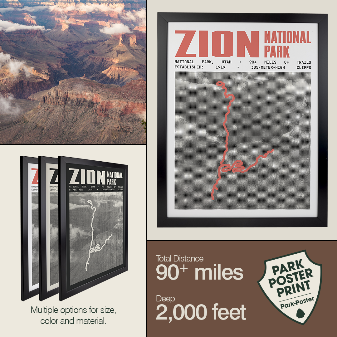
National Park Posters and Prints
Do you feel that your home lacks a touch of nature? Do your walls need something new? You've found the perfect solution—with our exclusive collection of National Park art. These premium pieces are more than just decor; based on National park maps, these posters are a tribute to your experiences, quests, and the natural beauty integral to your story.
Our exquisitely curated selection of National Park prints serves as more than wall art. These vibrant prints capture the stunning landscapes and unique geologic formations, evoking memories of your park adventures. These posters reflect your journey and highlight your achievements, reminding you of your exploration and the significance of preserving these natural marvels for future explorers.
Customize Your Poster
You can tailor your National Park poster according to your preferences. Do you want to frame your chosen posters to match your décor seamlessly, or do you like our striking Canvas Prints in versatile sizes suitable for any wall? You're in control. Moreover, you can add a personal touch to your poster with your image and unique details, making your wall art a bona fide keepsake of your park experiences.
Quality You Can Trust
All our posters are 100% American-made and printed on premium paper with vivid colors, highlighting our commitment to high-quality products. Your satisfaction is our priority—if you're not happy with your purchase, we provide a 30-day money-back guarantee.
So don't wait! Celebrate your journey, inspire a love for nature, and commemorate your happy memories with our National Park posters.
Make Your Adventure Memorable
Successfully navigating national parks without cell service creates lasting memories and builds essential outdoor skills. Each park offers unique landscapes, challenges, and rewards that feel more meaningful when earned through preparation and skilled navigation. These experiences not only strengthen your connection to nature but also inspire pride in your achievements.
After your adventure, celebrate with premium national park artwork that captures the essence of your journey. Companies like Park Poster offer museum-grade prints featuring bold maps, iconic stats, and trail-specific designs. These high-quality posters make perfect additions to any adventure lover's home, helping you relive your experiences and inspire future trips.
Showcase Your Adventures with National Park Posters Posters
Order your National Park Poster to showcase your favorite park or hike. Our National Park prints are more than just wall art; they are stories of your explorations! Each print captures the essence of one of our beloved National Parks. Order yours today to keep your adventurous spirit alive!